VIDEO: Satellite Images Show Devastating Impact Of Fires On L.A. Neighborhoods
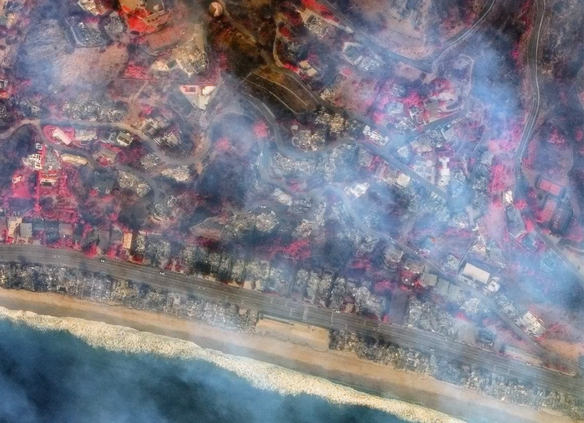
Images provided to Storyful by Maxar Technologies show destroyed structures in Pacific Palisades and along the coastline between Malibu and Santa Monica. In east Malibu, beachfront homes along the highway were also reduced to ash.
According to Cal Fire, nearly 30,000 acres of land have been burned in the wildfires around Los Angeles, and over 10,000 structures have been destroyed.


Leave a comment