

What Is A Bomb Cyclone, The Variety Of Snow Storm Pelting The Northeast?
A so-called ‘bomb cyclone’ is swirling northward along the east coast of the U.S., bring snow, ice, and wind.
WHAT IS A BOMB CYCLONE?
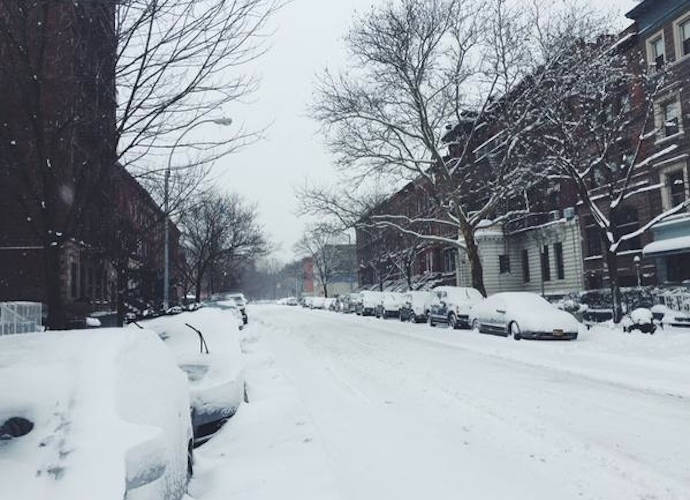
The National Weather Service has issued blizzard warnings in many parts of the Eastern Seaboard between North Carolina and Maine. Travel is considered “very dangerous to impossible” in multiple areas. Blizzard-like conditions have persisted all of Thursday along the eastern coastline. New York City was forecast to receive 5-8 inches of snow, while parts of Queens and Nassau County are expected to get up to 10. New England is forecast to get hit the hardest, with Boston to receive 10-14 inches of snow. Temperatures are also expected to fall as low as -25º Fahrenheit in parts of the Tri-state area, with winds up to 50 miles per hour.
Meteorologists have dubbed the freezing storm a bomb cyclone, because it undergoes “bombogenesis” as it intensifies over a short time period. What turns a storm into a bomb is the speed at which the atmospheric pressure drops. By definition, the barometric pressure must drop at least 24 millibars within a 24-hour period is known as a bomb cyclone.
The drop in barometric pressure occurs when a region of warm air intersects with one of cold air. The air moves around each other, creating a swirling effect – in the Northern Hemisphere, this creates a cyclone moving counterclockwise, leading to a Nor’easter – when winds come out of the northeast.
This is what happened at the end of October, though of course then it did not result in a snow storm, a bomb storm nonetheless. Many residents in Maine lost power and winds took down trees.
 Click here for the In Memoriam: Celebrities Who Died In 2017 Slideshow
RELATED ARTICLES

Get the most-revealing celebrity conversations with the uInterview podcast!


Leave a comment